THE ISSUE
Large amounts of complex geotechnical data sets are collected at mine sites. However, their use to evaluate risk is often limited, due to the lack of appropriate tools and processes to fuse and analyze these data.
THE SOLUTION
In order to facilitate analyses, Mira Geoscience developed and calibrated the Geohazmap Workflow, a powerful solution for geotechnical hazard estimation and monitoring.
THE RESULTS
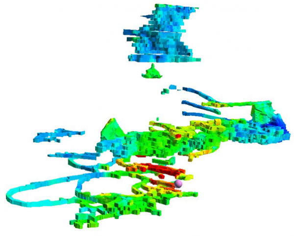
Geohazmap Workflow permits the combination of multiple technical criteria using a variety of knowledge and data-driven methods to highlight hazardous ground in underground mines. Calibration and development were performed in order to identify the risk related to fault-slip-caused rock bursting. Given that the mining environment is dynamic (i.e. conditions evolve with increasing production), the tool has been adapted to handle 4D data (space and time). This allows assessments of the risk encountered by underground openings at any point in time.
Contact
- John McGaughey, Mira Geoscience
- 514.489.1890
- johnm@mirageoscience.com
- www.mirageoscience.com
![]()
Solution team
- Damien Duff, CEMI
- Benoît Valley, CEMI
- Denis Thibodeau, Vale
- Steve Falconer, Xstrata Nickel
- Brad Simser, Xstrata Nickel